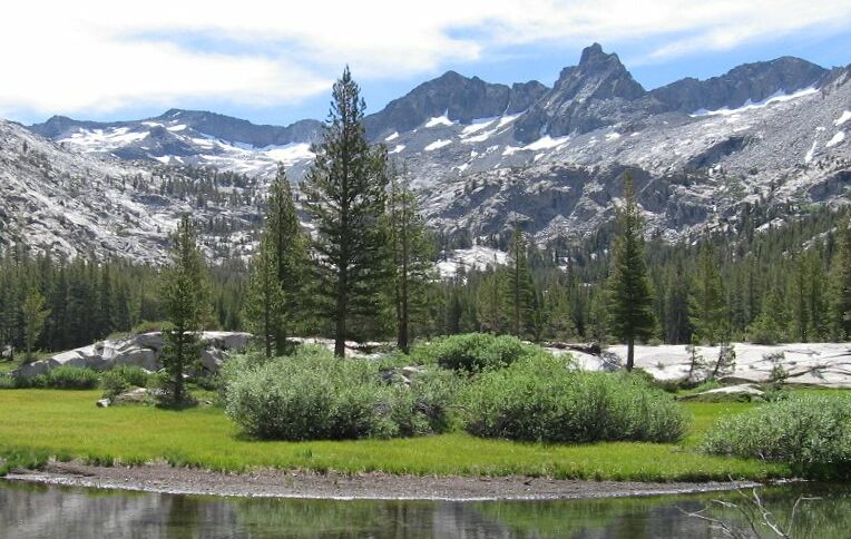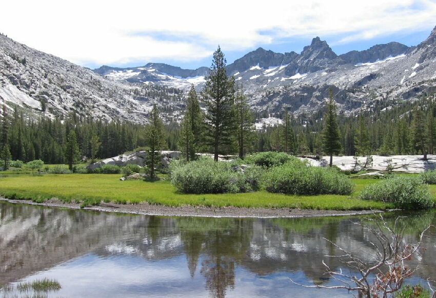
My picture to reproduce the Ansel Adams and T. Solomons pictures.
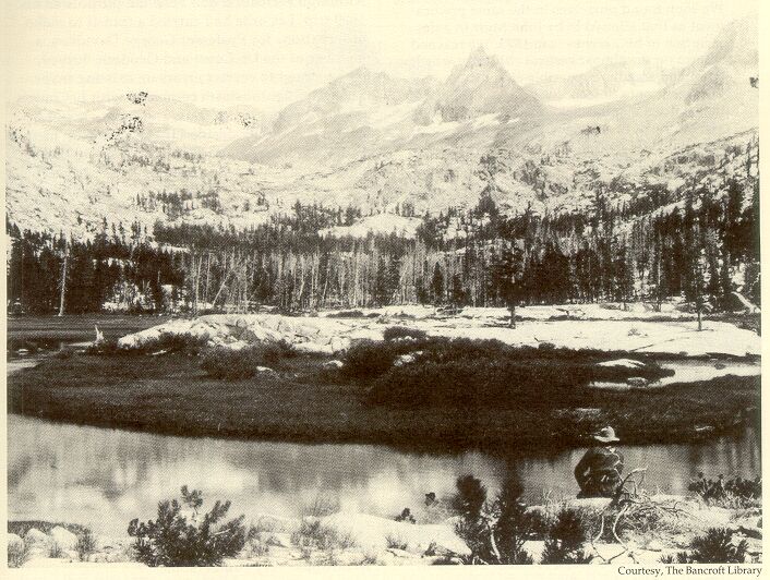
Ansel Adams picture (taken in the early 1900's) from the same angle and position as the picture Solomons took in the 1800's. Visit the Ansel Adams Gallery for reprints.
A Backpack to the Remote Lyell Fork of the Merced River
My picture to reproduce the Ansel Adams and T. Solomons pictures.
Ansel Adams picture (taken in the early 1900's) from the same angle and position as the picture Solomons took in the 1800's. Visit the Ansel Adams Gallery for reprints.
The Lyell Fork of the Merced River Vista!
A Trail and Cross-Country Route to the Lyell Fork, July 2007
Breaking free of the forest with its low green groundcover and streams we came on the second large meadow, and one of the primary reasons I wanted to get to this location. In 1892 and 1896 Theodore Solomons, the pioneer of the John Muir Trail, visited this very spot and photographed the Lyell Basin. For a very long time I have wanted to reproduce his and Ansel Adams pictures and see how much has changed since then, 115 years now. The answer is, things have changed, mostly due to global warming. I could not exactly reproduce the Solomons picture because trees have invaded the line of sight and where I needed to stand, though those trees may soon fall victim of a coming blight (more on that later). Ansel Adams also tried to reproduce the Solomons picture with more success because conditions had not changed all that much in the early 20th century. Today, many of the small bush sized trees in the Solomons and Adams pictures have grown into tall trees. Winter and cold could not beat back the trees and warmer weather and drier conditions have allowed trees to grow and invade the meadows.

A slightly different framing of my same picture.

The T. Solomons picture from about 1896.
I am sure you have seen the pictures here, but I was rather fascinated by the island of rock surrounded by the moat of the stream, backed by the expanse of meadow and framed by a skyline dominated by Mt. Ansel Adams. This was quite a pleasant alpine vista and a real motivator for doing this trip.
Heading down stream a ways and above the stream I found a small but mostly seldom used campsite, perfect for the true mountaineer who can do without a fire (see the previous page). It was elevated with other flat spots nearby and mounds that would guarantee places to sit with a view over the meadow expanse.