A Backpack Cross-Country Traverse of the Minarets
Nancy Pass is not so dangerous as steep and rocky. This is near the real beginning of the pass route. It pays to take your time and pick your steps. You will have to stop often enough to catch your breath, which was harder for me then because of congestion from being sick the previous week and still not recovered. The route here I chose was to head to the right of Dave between the bushes and head for the wall of rocks above, then follow the wall to the left upward, keeping to more solid ground. Dave just sort of plowed ahead...
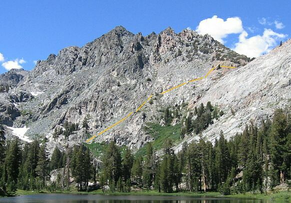
Nancy Pass
A Cross-Country Traverse of the Minarets, August/September 2006This is how you can do Nancy Pass. It may seem better to go right up the gully, but it is bushy and very steep. The fishermen tried it and they said it was very bad. The route we use was clear and simple. To do this pass you start from the bottom left, and stay to the left of the steep centerline pass gully, walking mostly on stable scree and dirt (except for a last loose bit at the top).
From the top page picture you can see it is not as steep as it appears here in this picture (though it is pretty steep!). This however is generally the best route, and you do not have to be Spiderman to do it.
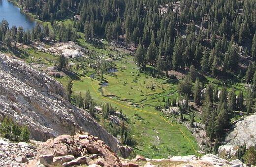
We started by crossing the stream and following it to the end of the meadow near the stream. We then came to trees and dirt with some runoff coming down a gentle slope, which we followed upward (see the picture below). Soon the dirt and trees gave way to a large granite dome, which we stayed near the right of.
Follow the outlet stream through the meadow then follow to the right of the brown dirt area on your left till you get to the corner of the big rock dome you see in the corner of the picture. Staying close to the rock, go up a bushy grassy slope to a shoulder then turn uphill to Nancy Pass. The way becomes suddenly steeper next to the dome (seen in the picture below), and we followed to the right of the dome through bushes (easy to get through) to a level shoulder. Turning right near a boulder, we were faces with the scene pictured at the top of this page, the Nancy Pass cross-country route.
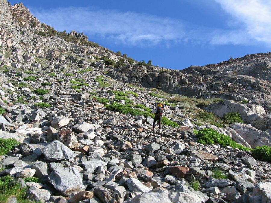
This is near the bottom of the pass before you start up the rocky scree slope. To get to this point, follow the instructions above, going around from the left of the rock mid-picture. When you get to the boulder at the right of the picture, turn right and go up the rocky pass route seen in the top picture of this page. Superior Lake can be seen in the distance. Fortunately, getting to the top of the pass is less than a half mile and about 830 feet of gain, from top to bottom. Still, it is a whole heck of a lot of work to slog up that thing, and easily the hardest thing we did on this trip.
As I said in the picture captions, I tried to keep to the solid ground between the scree and rocks when I could, which surprisingly was a great deal of the climb. Dave was more into the going straight up approach, never mind what was in the way. I zigzagged. There was some pretty obvious rock dikes to shoot for and go around (to the left) and the going was pretty steady for all the heavy breathing. There were even a few level spots to stand and take in the view and air. The way was just heavy steep work and non-threatening by staying in safe areas. At one point near the top, the scree gave way to very loose soil that resisted hiking. I beat it by staying on plants and rocks where I could and kicking in steps. Finally near trees, I could look over to my right across the pass gully and see that the top was near. It this point I traversed right through solid and loose soil to get to the pass gully, and seeing trees above, headed for the opening on the right and the top of the pass. On top at last!