A Short Trip in the Pioneer Basin Area
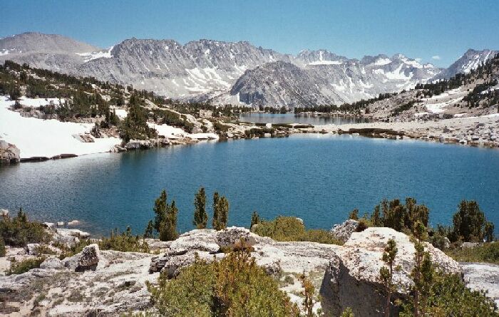
Upper and lower lakes 10820 Feet. Just above the lower outlet you can see Mono Rock, and to the left is Fourth Recess and Mono Pass.
The Lower Basin
A Pioneer Basin Trip from Edison Lake, June 2003
The trail continued around the lake then finally faded away at the end of the lake. It was just as well, because all route-finding was fairly obvious in the basin. One of the reasons I wanted to do this area in June was because there was a lot of southern exposure in Pioneer Basin, which meant the snow would be gone early. I was kind of surprised I did not find more snow on the way to the basin, and in reality I found only one small patch near the trail. In the basin itself, most snow was found only in sheltered spots in thick banks. The snow was firm enough to walk on, which was good because we had to cross a fair number of patches. It was all good.
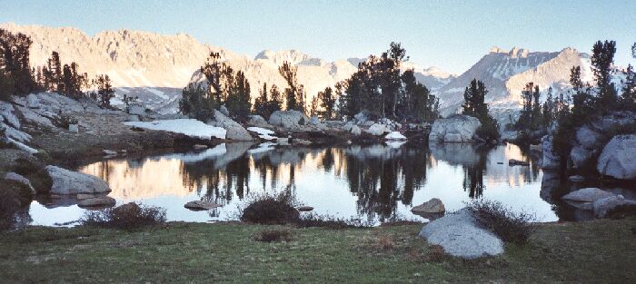
The small pond near camp, looking south in the evening towards Mono Pass. Off to the left was a great spot to see the panoramic view of the Mono Creek Canyon, the Mono Divide, the Recesses and more. You will see this view later.
We headed to the north end of the second 10820 lake and enjoyed the view south of the Mono Divide. We crossed a few snow patches, which was not a problem, and we were glad for the lack of mosquitoes. Mostly we were glad for the ever improving views the higher we climbed.