The Grand Canyon of the Tuolumne and Falls
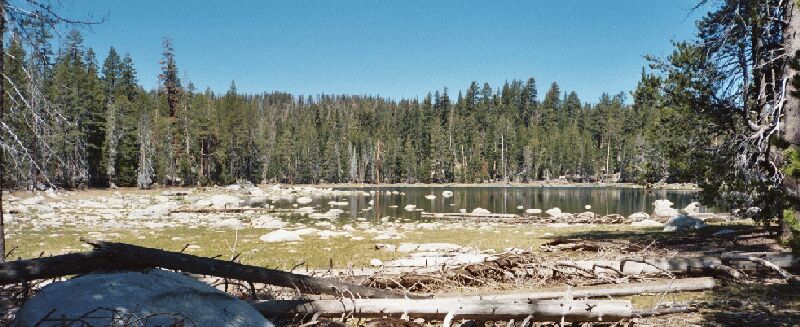
Harden Lake. Even in early season, this lake was a bit dry. In wetter years, the water would be all the way up to the deadfall in the lower picture. There is camping available at this lake. Expect to see day-hikers during summer.
Harden Lake
The Grand Canyon of the Tuolumne and Falls, June 2004The next 1.7 miles to the next junction were easier than the last few miles, loosing 373 feet and regaining 186 feet. The grades were slight and seemed mostly level with fairly effortless hiking. The forest was still thick enough to block any far views, but it was nice to just swing along enjoying the hike. A number of pocket meadows were passed, some flooding the trail in spots. I was on the lookout because this was prime bear and deer country and I was hoping to see some wildlife.
Harden Lake hove into view at long last, but was mostly a disappointment. I have pictures from others of a full lake, but this shallow lake was half empty...or half full, depending on your point of view. At about the time I saw the lake we also hit road. The area had buildings, fences and at the junction, the usual and some times inaccurate Yosemite iron signs.
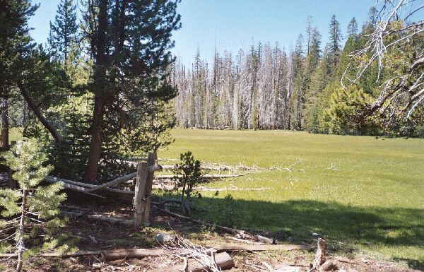
White Wolf is just down the road (which I was standing on to take this picture), so you will see signs of man, like fences and buildings. One of the meadows in the Harden Lake area.
It was getting near lunch or a least snack time, but the area held no interest for us, so we decided to go down trail to find a good spot to rest, eat and have a view. Leaving the clutter of iron Yosemite trail signs at the junction, we headed north-east for Pate Valley.
After rounding Harden Lake on fairly level tread and passing a minor trail junction, we began our plunge down into the Grand Canyon of the Tuolumne River.